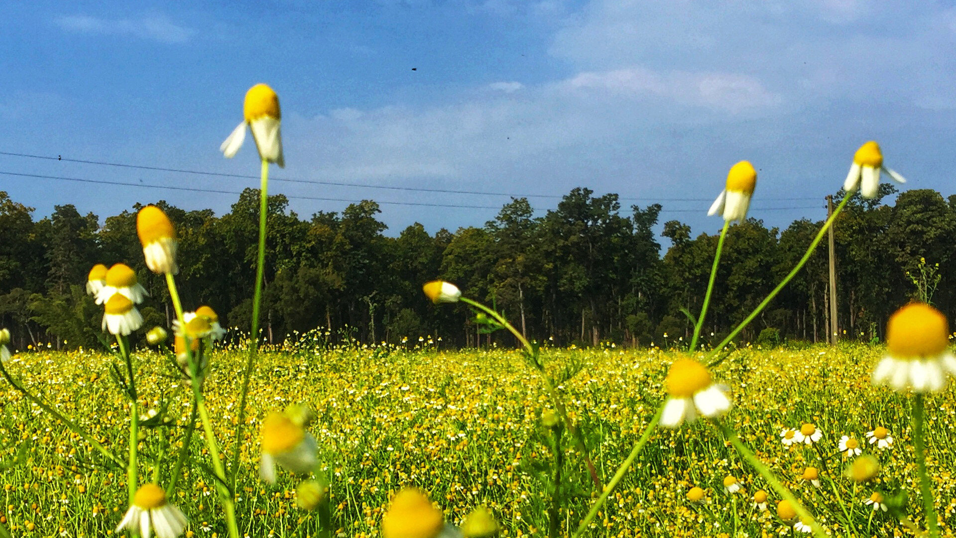
Nepal is home to an avid diversity of flora and fauna, which range from the lowlands of Terai to the Himalayan mountains. Each bio-zone host's multiple ecosystems, which are called home by thousands of species of birds, mammals, reptiles and amphibians. Nepal’s natural beauty has always been its pride and conserving it has always been a top priority. Thus under the National Parks and Wildlife Conservation Act, 2020 (1973AD), the government of Nepal created the guidelines to declare and maintain National Parks, Conservation Areas, and Hunting Reserves
Khaptad National Park
Shey Phoksundo National Park
Bardiya National Park
Makalu National Park
Today the protected areas of Nepal cover mainly forests and are located at various altitudes in the Terai, as well as in the foothills of the Himalayas and the mountains themselves. Nepal even though is small in terms of area size covering only 147,181 sq km. The altitudes range from 67 m to 8,848m. This extreme altitudinal gradient has resulted in 11 bio-climatic zones ranging from lower tropical below 500m to nival above 5,000m in the High Himalayas encompassing nine terrestrial ecoregions with 36 vegetation types. The government of Nepal under the National Park and Wildlife Conservation Act, 2020(1973AD) established a total of 12 National Parks, 1 Wildlife Reserves, 6 conservation Areas and 1 Hunting Reserve. In 2017, the Shuklpahanta and Parsa Wildlife Reserves were upgraded into National Parks.
In this series of articles, we explore the various National Parks, their level of accessibility and attractions.
Khaptad National Park
Province: 7
Distance From Kathmandu: 448 km
Accessibility: 2-day trek from Silgarhi Bazar. One can reach Silgarhi Bazar either by taking a flight to Dhangadi and driving to Silgarhi Bazar (6hrs) or get a bus to Attariya Chowk, Kailali from Central Bus Station in Kathmandu and then it's another 9 hours to reach Silgarhi Bazar via a local bus.
Attraction: Ashram of Khaptad Baba, Saileswori, Ramroshan, Bird Watching, Trekking, Wildlife Photography.
Khaptad National Park was established in 1984 on the advice of the region's holy man Khaptad Baba. The renowned Khaptad Baba Ashram, a religious site where Hindu pilgrims come to worship Shiva on the full moon of July–August each year, is located near the park headquarters. A buffer zone of 216 km2 (83 sq mi) was declared in 2006. Khaptad Baba moved to the area in the 1940s to meditate and worship. He spent about 50 years as a hermit and became a renowned spiritual saint. Khaptad National Park is a protected area in the Far-Western Region, Nepal that was established in 1984. Stretching over the four districts of Bajhang, Bajura, Achham and Doti it covers an area of 225 km2 (87 sq mi) and ranges in elevation from 1,400 m (4,600 ft) to 3,300 m (10,800 ft).
Shey Phoksundo National Park
Province: 6
Distance From Kathmandu: 315 km
Accessibility: By air, Shey Phoksundo can be only accessed through Nepalgunj or which has to take a flight to Nepalgunj and from there to Juphal in Dolpa. By road, it makes 3 hrs 40 minutes to reach Shey Phoksundo National park via a private vehicle.
Attraction: Shey Phoksundo Lake, Trekking, Shey Gompa Monastery, Crystal Mountain, Landscape Photography
Season: Spring and Autumn
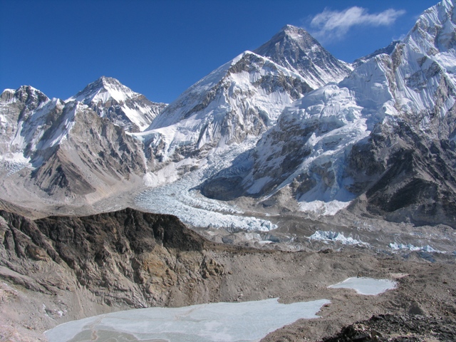
Shey Phoksundo National Park is the largest and only trans-Himalayan national park in Nepal. It was established in 1984 and covers an area of 3,555 km2 (1,373 sq mi) in the districts of Dolpa and Mugu in the Mid-Western Region, Nepal. The protected area ranges in elevation from 2,130 to 6,885 m (6,988 to 22,589 ft).Phoksundo Lake is the park's prominent feature, located at an elevation of 3,612 m (11,850 ft). Shey Phoksundo National Park provides a diversity of spectacular landscapes and ranks among the most scenic mountain parks in the world. Much of the park lies north of the Himalayan crest. Elevations range from 2,130 m (6,990 ft) in the southeast near Ankhe to 6,883 m (22,582 ft) at the summit of Kanjiroba Himal, which lies at the southern edge of the Tibetan plateau. Phoksundo Lake lies at an elevation of 3,660 m (12,010 ft) in the upper reaches of the Suligad river. It is surrounded by glaciers and famous for its magnificent turquoise colour. Near the lake’s outlet is the country’s highest waterfall.
Phoksundo Lake has a water surface of 494 ha (1,220 acres) and was declared a Ramsar site in September 2007. The lake is up to 145 m (476 ft) deep, measured using echo-sounding technology.
The Langu river drains the high Dolpo plateau located in the north-east of the park. The Suligad and Jugdual rivers form the southern catchment flowing south into the Thuli Bheri River.
Bardiya National Park
Province: 5
Distance From Kathmandu: 376 km
Accessibility: By Air Kathmandu- Nepalgunj from where the park is 87 km. One can then catch a bus to Mahendranagar or Dhangadi via Ambassa then change the bus to Thakurdwara for Baridya National park. The drive takes around 3 hours by public bus.
By Road, one can catch a bus to Mahendranagar or Dhangadi via Ambassa Bardia. The drive averages out to 13 hours.
Attraction: Adventure Hikes, Bird Watching, Tiger Sighting, Butterfly Watching, Wildlife Encounters, Landscape and Wildlife Photography
Bardiya National Park is a protected area in Nepal that was established in 1988 as Royal Bardia National Park. Covering an area of 968 km2 (374 sq mi) it is the largest and most undisturbed national park in Nepal's Terai, adjoining the eastern bank of the Karnali River and bisected by the Babai River in the Bardiya District. Its northern limits are demarcated by the crest of the Siwalik Hills. The Nepalgunj-Surkhet highway partly forms the southern boundary, but seriously disrupts the protected area. Natural boundaries to human settlements are formed in the west by the Geruwa, a branch of the Karnali River, and in the southeast by the Babai River.
Together with the neighbouring Banke National Park, the coherent protected area of 1,437 km2 (555 sq mi) represents the Tiger Conservation Unit (TCU) Bardia-Banke that extends over 2,231 km2 (861 sq mi) of alluvial grasslands and subtropical moist deciduous forests.
Makalu National Park
Province: 1
Distance From Kathmandu: 175 km
Accessibility: By air to Lukla, Phaplu, Lamidanda, Bhojpur or Tumlingtar. After which one can take a means of public transport to reach the national park
Season: Spring and Autumn
Attraction: Bird Watching, Trekking to Yangle Kharka, Snow Leopard Sighting, Wildlife Encounters, Landscape Photography
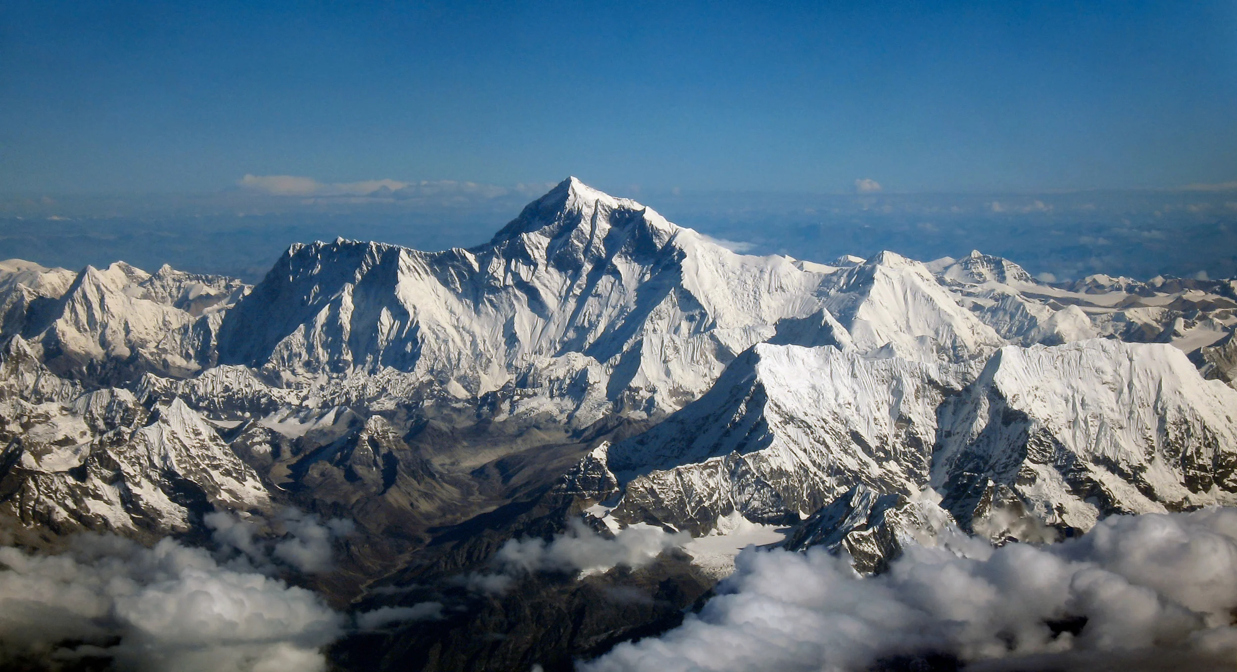
Makalu Barun National Park is a national park in the Himalayas of Nepal that was established in 1992 as an eastern extension of Sagarmatha National Park. It is the world's only protected area with an elevation gain of more than 8,000 m (26,000 ft) enclosing tropical forest as well as snow-capped peaks. It covers an area of 1,500 km2 (580 sq mi) in the Solukhumbu and Sankhuwasabha Districts and is surrounded by a buffer zone to the south and southeast with an area of 830 km2 (320 sq mi).
The rugged summits of Makalu, with 8,463 m (27,766 ft) the fifth highest mountain of the world, Chamalang (7,319 m (24,012 ft), Baruntse (7,129 m (23,389 ft)) and Mera (6,654 m (21,831 ft)) are included in the national park. The protected area extends to about 66 km (41 mi) from west to east and about 44 km (27 mi) from north to south. From the Arun river valley in the southeast, located at altitudes of 344–377 m (1,129–1,237 ft), elevation gains about 8,025 m (26,329 ft) to the peak of Makalu. The national park shares the international border with the Qomolangma National Nature Preserve of the Tibet Autonomous Region in the north.